Back to zydromarine.com
Add Nautical Charts to your Web App
The easiest way to add beautiful, informative vector nautical charts to your maritime-related product.
Try it Out - Drag to pan
Wide Compatibility
Our APIs are compatible and tested with many popular GIS tools and web map rendering libraries.

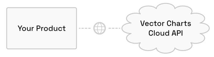
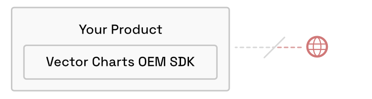
Multiple Deployment Options
Use our turnkey Cloud API, or embed the Vector Charts SDK directly into your product.
Try It Out
Test our chart rendering with Vector Charts Viewer, our free web & mobile marine navigation app.
.png)


Vector Charts is built by Zydro Marine Technologies, Inc.